The Heritage offices of Laois, Carlow and Kildare County Councils, working with video makers Bailey and Blake, are looking for the memories from local families about the famous Gordon Bennett motor race of 1903.
This was the first ever international sporting race in Ireland, which brought the biggest ever crowds, and was probably the first time many people of Ireland had ever seen a car.
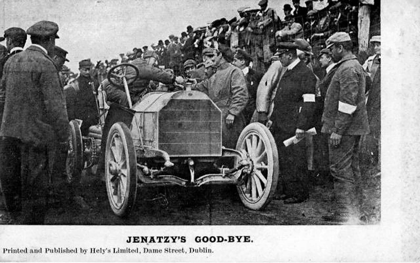
Jenatzy, 1903 Gordon Bennett winner, driving a Mercedes. Source: Postcard, published by Hely’s Ltd., Dublin
We want to find anyone who has old photos, maybe a postcard, a flag or just stories handed down the generations about this momentous race.
Did your family rent out a field to watch? Does your family have memories of RIC members coming to the area ? (Over 2000 of them were drafted in to work at marshalling from all over the country). Did one of the cars break down outside your house? Did someone in your family sell food or water to the hungry spectators?
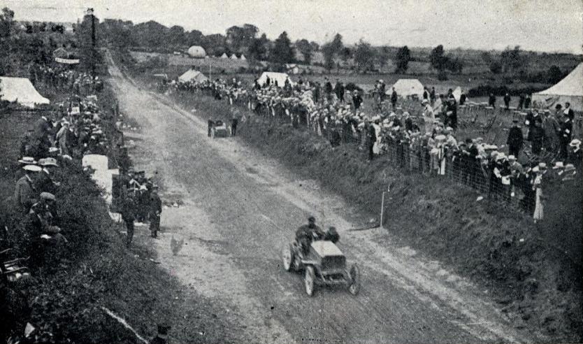
1903 Gordon Bennett Trophy. René de Knyff, driving his Panhard to second place, passes Alexander Winton repairing the Winton Bullet 2 on the first lap. Source: Printed and published in 1903 by Hely’s Ltd, Dame Street, Dublin. Photographer and current owner of copyright are lost to history.
The Heritage Office of Laois County Council, with the support of the Heritage Council want to bring those memories and photos together for documentary makers Bailey and Blake to help illustrate this event for everyone locally to be proud of, and to tell the story to the worldwide motor racing fraternity, and learn about the race that is said to have saved motorsport.
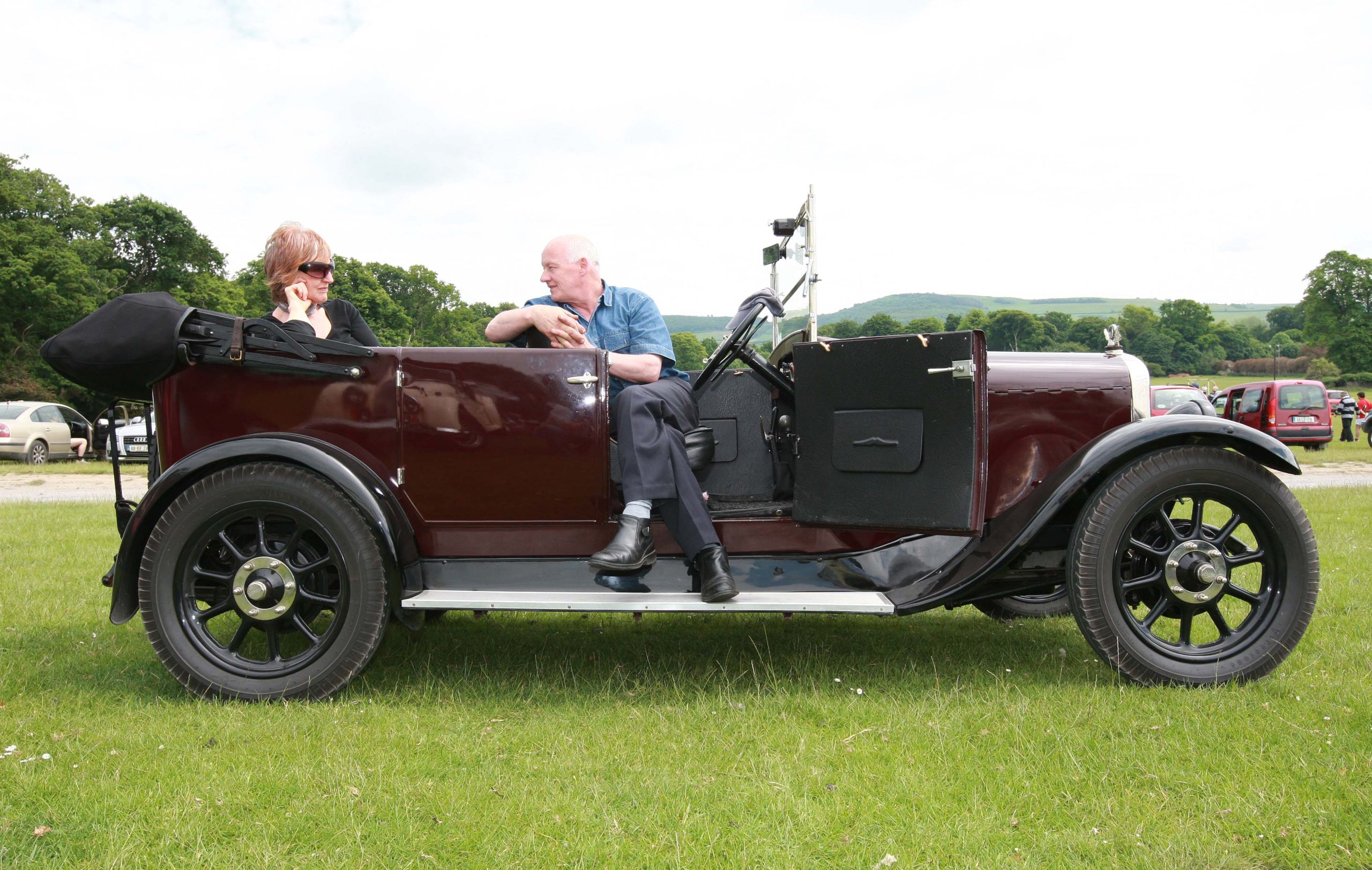
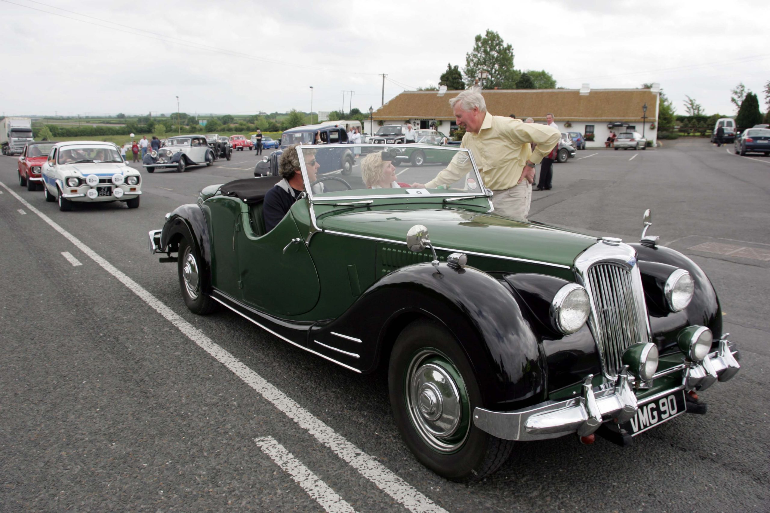
Michael McCormack and Anne Fullam in Michael’s 1928 Austin at The Lawn Stradbally for the Gordon Bennett Picnic stop. Picture: Alf Harvey.
Catherine Casey Heritage Officer with Laois County Council said “Many people will know of the original race through the Gordon Bennett Classic Car Rally, which makes its annual come-back after Covid on the June Bank Holiday this year. We are delighted to be working with Bailey and Blake on this film project and we hope that as many people as possible will take par and share their family memories”
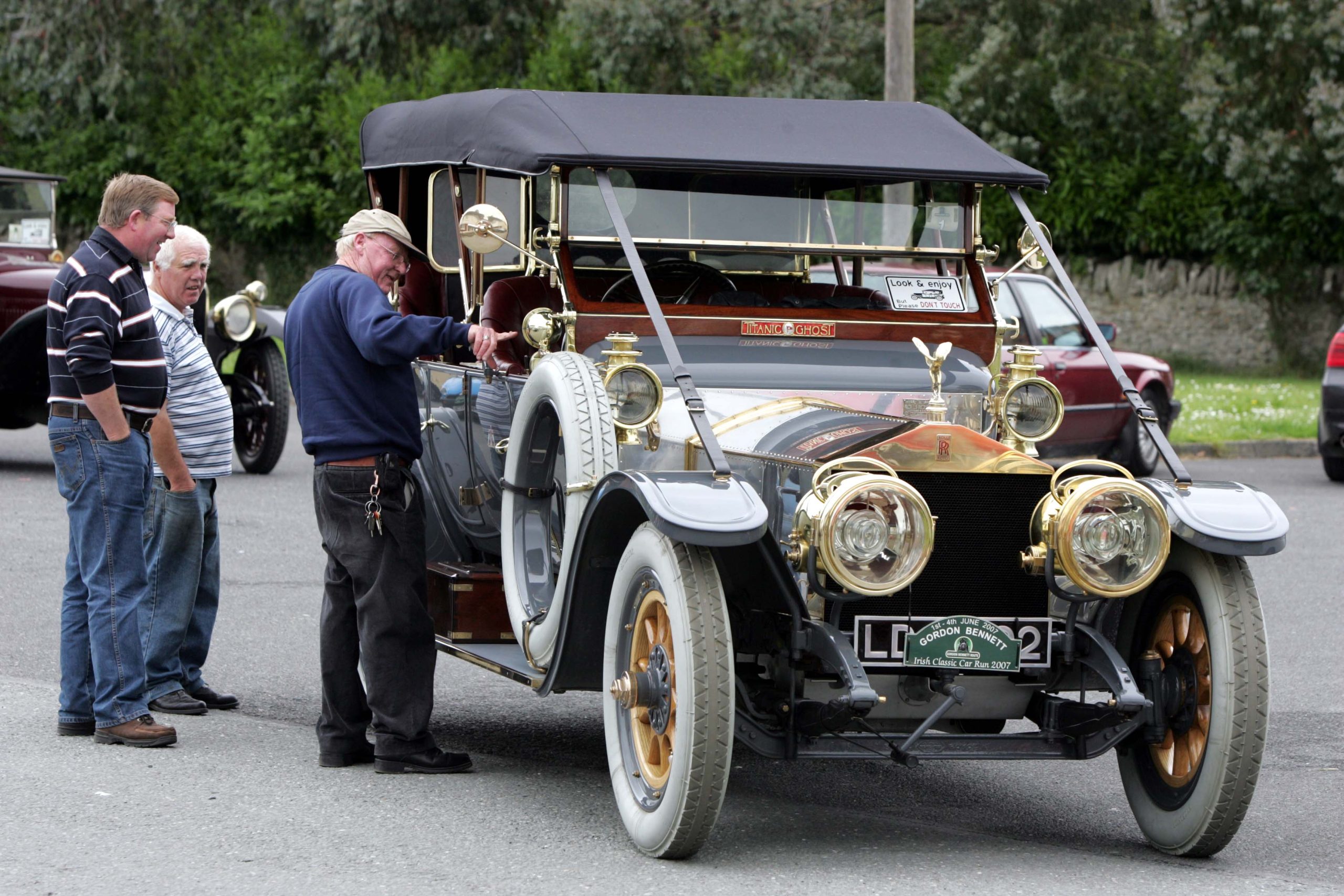
William Molloy, Stradbally and Sean Sleator and Paul Hurley, Graiguecullen view the Titanic Ghost Rolls Royce at Stradbally for the visit of the Gordon Bennett Rally. Picture: Alf Harvey.
To share a memory , or maybe a photo or two, please contact the Bailey and Blake team on gordonbennettstory@gmail.com or text 087 2539010
The Gordon Bennett Film is a project of the Heritage Offices of Carlow, Kildare and Laois County Councils, supported by the Heritage Council.
George Dalton with Malcom and Gail Lomas and their 1949 Riley Roadster at the Irish Gordon Bennett Classic Run 2004 at Treacys’, The Heath. Picture: Alf Harvey.
Construction works are continuing for the Portlaoise and Fort Protector Enhancement Project Phase II at Church Street, Portlaoise, Co. Laois. These works include the removal of overhead powerlines and associated ESB poles, and the construction of new underground ducts for services. The works area taking place along the path and roadway beside the northern wall of Fort Protector which is a known and legally protected archaeological site. The ground disturbance works are being archaeological monitored, which is being carried out under archaeological licence 18E0339, by archaeologists from Colm Flynn Archaeology.
Discovery of 18th century culvert
During the monitoring of removal of existing road and path materials on the south side of Church Street beside the wall of Fort Protector, an 18th century mortar bonded stone culvert was identified. The culvert had been previously disturbed by utilities services and other constructions, but still appeared to carry water during rain periods. Some of the culvert has been piped with concrete drains in recent times. The culvert was constructed in the late 18th century when stone roads were being constructed in Portlaoise to aid trade and commerce.
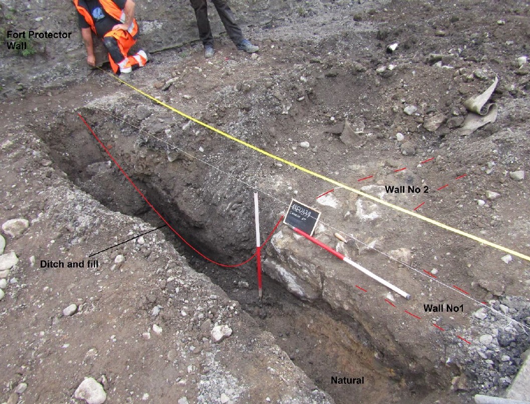
Archaeological monitoring of works along the east end of Church Street near Fitzmaurice Place resulted in the identification or previously unknown archaeology. Two stone walls and a ditch were identified under the existing path and road near the corner tower of Fort Protector. The walls likely mark the location of a building and artefacts recovered from the area indicate that the building could date to the 16th century. One of the building walls is parallel to the northern wall of Fort Protector. Historic mapping (see 1560 map below) that survives for Portlaoise shows us what the houses in the 16th century would’ve looked like. The houses would have been Tudor style, storey and a half buildings, with thatched roofs, and central hearths or chimneys.
Laois County Council have ensured that the works did not impact on the archaeological walls which were preserved in situ under a protective membrane and sand.
Image showing walls and ditch identified in slit trench for ESB lighting pillar on Church Street, facing west
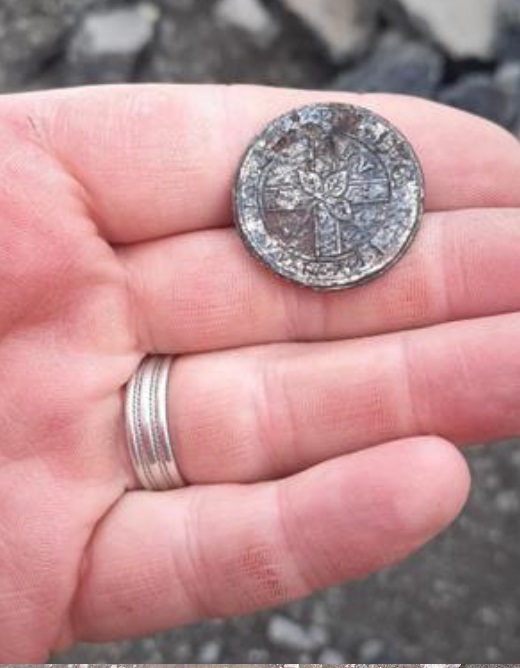
A filled in ditch cutting was also identified at the location of the walls (see image above). The ditch was identified immediately against the north wall of Fort Protector. The ditch had been backfilled with soil and stone. The ditch was likely an external ditch around the outer wall of Fort Protector and may date to the 16th century. Several artefacts were identified and recovered from the ditch fill, including post medieval pottery, animal bone, and a military uniform button (see image below).
Image of Royal Irish Dragoon Guards button from ditch fill
The button is a uniform button from the Fourth Royal Irish Dragoon Guards who were stationed in Portlaoise in the end of the 18th century, and mustered to crush the 1798 Rebellion. The button features St. Patricks Cross, and the shamrock, with the Roman Numerals ‘IV’ in the corner indicating the ‘Fourth’ of the regimental name. On the base of the button is the Latin regimental motto ‘Qui separabit’, which translates as ‘who will divide us’.
Image of 16th century green-glazed plate sherd from excavation
The pottery sherd is from a domestic serving platter and dates to the 16th century. This platter or plate would have been used in one of the homes of the English settlers in Portlaoise.
The ditch and walls are not depicted on any maps of the area, although the 1560 map of Portlaoise (Maryborough) shows a building to the north of the north wall of Fort Protector (see maps below). The stone culvert previously discussed had been constructed in the backfilled ditch, indicating that the ditch predates this construction. A road is depicted at the location of the Church Street on the 1721 Parnell Estate map (see below) and subsequent 19th century Ordnance Survey maps. The presence of roads on these maps at the location of the walls and ditch indicate that the walls and ditch predate the 18th century and based on their location and associated artefacts, date to the 16th century. The walls may represent the remains of one of the first settler homes of the Tudor Plantation of Laois and Offaly. The archaeological monitoring of works has afforded us the opportunity to identify and preserve nearly 500 year old archaeology, and to examine the unique heritage of Portlaoise, as Irelands first plantation town.